Articles about maps
History of cartography
All about topographic maps
Topographic maps and traveling
Two centuries of Russian Cartography
Navigation software and offline maps
History of cartography
Cartographic maps of ancient East
Cartographic maps of ancient Rome
Cartographic pictures of primitive people
Cartography and geography in ancient Greece and Hellenistic countries
Cartography and geography in Armenia and in countries of Arab Caliphate
Cartography in slave-holding China
First Maps
Literature and Astronomy
Pythagoras and first hypothesis about Earth’s size
Strabo and cartography
The development of Russian Topography
The origins of astronomy
The origins of cartography
Why we so many ancient maps diasappear?
Cartographic pictures of primitive people
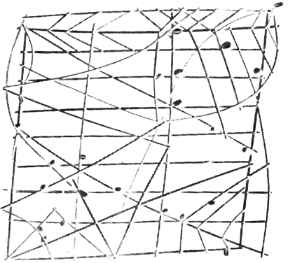
The basis of any historical research is historical sources – facts which came to nowadays from past epochs of human development. Maps, geographic works and other written works – direct evidence of the past – represent especial value for the history of cartography. Only few sources of the time, when there was no map printing, reached our days. Map is a fragile thing. Deterioration, damp, fire, at last absence of care of storing pictures that lost their significance and other reasons which explain the loss of a great amount of ancient maps. First simple sketches date back to the primitive society, before the emergence of written languages. This fact is testified by map images from the primitive peoples who by the time of their discovery or examination stood at low levels of social development and had no written language (small peoples of Siberia and the Far East, the Inuit of North America, American Indians, Micronesians of Oceania and many others). These pictures, performed on trees, barks, animals’ skin, etc.,served to meet the needs arising from the general conditions of human labor – to specify hunting places, ways of roaming, etc. These pictures were limited by to known places, in transferring which they were plausible.

A great interest represent so called “sea maps” – navigation aids for residents of Marshall Islands. Shells, denoted islands, consolidated on the carcass of palm fronds, and position of fronds indicated front of choppy sea, raised by dominant winds and changes while passing the chain of islands. It is this phenomenon which islanders took into consideration, while determining the direction on the island, when they dropped out of sight.
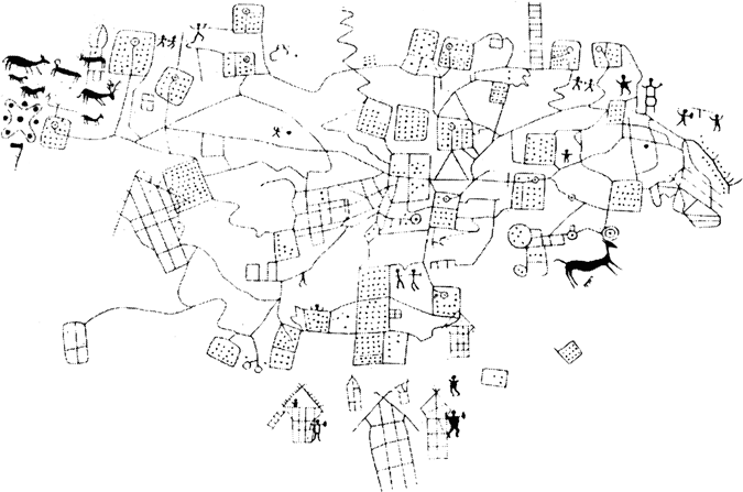
Up to the present cartographic sketches of 2d and 3rd century B.C. survived. Surprisingly detailed rock painting referred to Bronze Age was found in the Camonica valley (Northern Italy). It represented a plan of agricultural fields, walking trails, streams and irrigation canals. It is one of the oldest ancient cadastral plans.
But by its age especially remarkable is a painting on silver vase, which goes back to 3rd century B.C. It was found in excavations of one barrow near Maicop (North Caucasus). This vase is now stored in the Hermitage. The picture represents mountain range, where two river spring from, than flow into the lake (or sea), the forest is shown on the mountains, around lake and at the foot of the mountains there are a lot of animals. It is probable that this vase is of local origin and in this case it indicates the beginning of the USSR history of cartography.


