


News about maps
Digital cartography and GPS navigation
Mapstor news
This Day in History
Travelling with mapstor.com
Digital cartography and GPS navigation
115 years of flight
Next-generation of GPS satellites are headed to space
DJI Phantom 4 RTK - cartography of a new generation
Earthquake prediction systems
OneSoil map
Ultramodern time
In the 20th century maps became incredibly detailed thanks to aerial photography first, then to space images. However, satellite images, having quickly gained popularity turned into a tool of creation schemes. At the city scale, they are virtually useless. Over the territory of forests - are completely useless. Then to the aid came projects in which people can edit maps by their own. 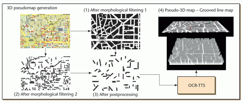
Nowadays, appear maps that reflect the interests of different people. Thus, the Greek researchers have developed a system that converts the image of a traditional paper map into three-dimensional city plans. With the help of gloves of virtual reality a blind person can literally touch the map and read data from it (or include a voice engine, voiced street names).
Airbnb experiments with the creation of maps which borders are delineated by cultural and contextual basis. On the map above traditional "tourist" places for living are marked in green, in red - housing from Airbnb base. Any map template recommend a house in the "green" zone, but a more complete impression of real life in the city can be found in the "red" area.
Now quickly gain popularity maps with additional value. For example, New York map indicates most criminal areas and areas where you can feel safe.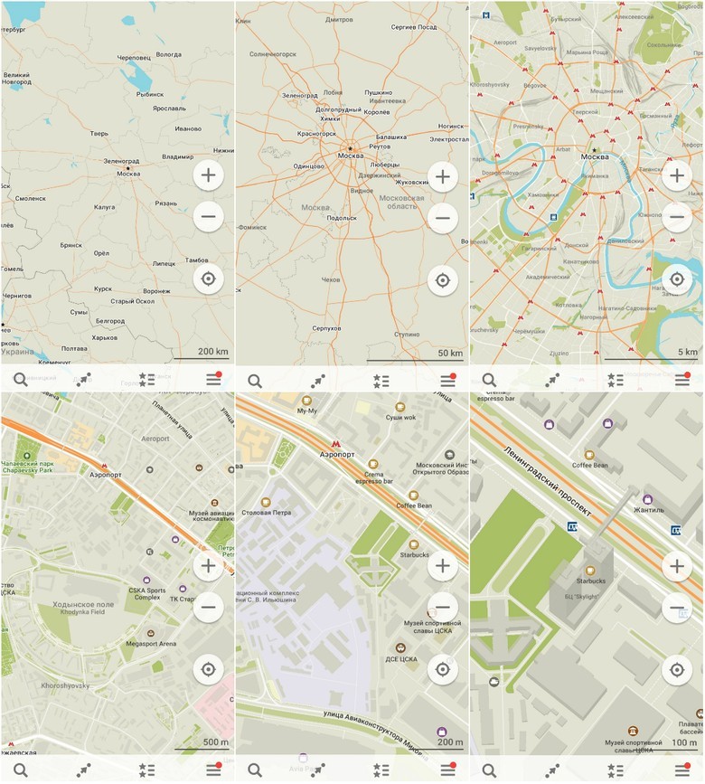
The second project with open source is OpenStreetMap. The goal of OSM project is to give everyone in the world a free map, on which you can do anything you want. For thousands of years this seemed to be incredible even pocket maps appeared only in the 19th century. Now, instead of pockets - a smartphone, and maps do not need internet. Another difference of OSM from last Cartography is accessibility. Everyone can make their own additions to the maps and it’s almost as simple as making changes to the Wikipedia article.
The advantages of open (in all senses) maps in commercial sphere is their flexibiblity. The same circuit with different terrain dataset is used in numerous situations. With OSM people mark trails in the woods and primers, food distribution points in the poorest regions, forest fires ... Yeah, whatever!
Disadvantages of the era
Comparing maps of the past - not only from the Middle Ages, but of two thousands years ago - with modern, one can conclude that maps have evolved into utilitarian and informational product. Design became simple, and maps themselves oddly enough, less detailed. Glancing at the painting of the Renaissance, you can see dozens, if not hundreds of additional objects along your route. The smartphone depicts only necessary information.
Modern maps create not artists/designers, not even mapmakers but programmers. This is the demand of the era, because if you do not adapt the map for any mobile device, it will be simply useless. Map ceased to be a work of art, deprived of horrible monsters who swallow ships, becoming the surprisingly uniform.
However, in comparison with the ancient maps modern maps have one significant advantage - they are very quickly changing. It can happen that one day a map will be completely personalized.
One of the interesting examples of movement toward "personalization" is an open source map of nearby Galton, created on the basis of the OSM. Map is named after Francis Galton - English explorer and geographer, who in 1881 drew a map «Isochronic passage chart», indicating the number of days for travel from the UK to various destinations.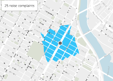
The map of "quiet" areas of New York, obtained based on the analysis of complaints about noise data
What makes this map? Besides the obvious solution (which can be reached within a certain time, if you can not walk on water and walk through walls), you can calculate the rating of the place based on a plurality of parameters located in the zone of walking facilities.
Sooner or later, a single map of the world will cease to exist, because for different groups of people, the world will be filled with different events. Metamorphosis will not affect the basic concepts, such as the conventional boundaries of states or distances between cities, but the motorist, pedestrian, cyclists and bars will find exactly what they are interested in in the geography of the surrounding area.
And the map will once again be a source of discoveries.
Digital cartography and GPS navigation 15-03-2017