News about maps
Digital cartography and GPS navigation
Mapstor news
This Day in History
Travelling with mapstor.com
Digital cartography and GPS navigation
115 years of flight
Next-generation of GPS satellites are headed to space
DJI Phantom 4 RTK - cartography of a new generation
Earthquake prediction systems
OneSoil map
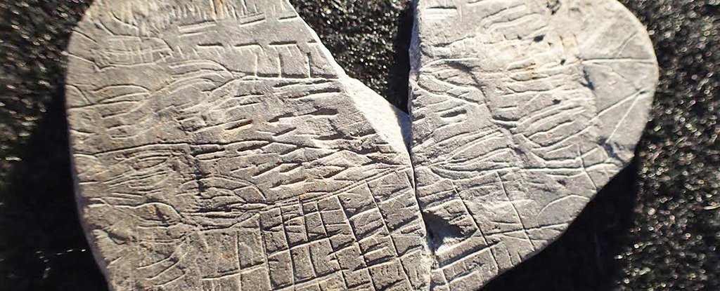
Found 5,000-year-old rock - one of the world's earliest maps
A mysterious stone found by archeology students during a summer dig on the island of Bornholm might be a 5,000-year-old map showing the location of different fields in the nearby area.
The stone, which is no more than 5cm long on the longest side, was found by an archeology student during the excavation of a Neolithic shrine at Vasagård on the southern part of the Baltic island.
Dr Flemming Kaul, an expert on Bronze Age iconography at the National Museum of Denmark, said that he now believes that the criss-cross pattern on the stone shows topographical detail of land on the island as it was between 2700 and 2900 BC.
“These are not accidental scratches,” Dr Kaul told the history and archeology magazine Skalk. “Some of the lines may be reproductions of ears of corn, or plants with leaves.”
Dr Kaul said that if the stone was indeed a map it would be “something very unique, without parallel”. Carvings on some rocks in Italy have been identified as maps but nothing similar has been found in Scandinavia.
The patterns on previous stones found at the site appear to show the sun and the sun's rays, and are thought to have been used in rituals.
Digital cartography and GPS navigation 15-11-2016


