


News about maps
Digital cartography and GPS navigation
Mapstor news
This Day in History
Travelling with mapstor.com
Digital cartography and GPS navigation
115 years of flight
Next-generation of GPS satellites are headed to space
DJI Phantom 4 RTK - cartography of a new generation
Earthquake prediction systems
OneSoil map
All space research missions on one infographics
Almost sixty years passed since the launch of the first artificial Earth satellite. Since then repeatedly mankind sent into space vehicles, animals and humans. Studio Pop Chart Lab made infographic, which depicts all possible probes sent into space to explore other planets and stars.
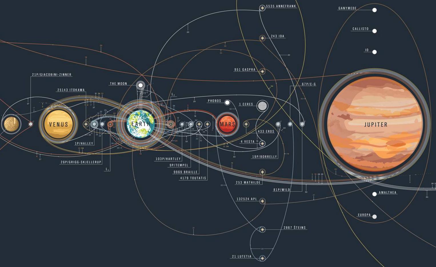
At the top of the poster you can see the path that crossed the spacecraft, and the bottom - how these devices look. In the table probes are separated by areas.