


News about maps
Digital cartography and GPS navigation
Mapstor news
This Day in History
Travelling with mapstor.com
Digital cartography and GPS navigation
115 years of flight
Next-generation of GPS satellites are headed to space
DJI Phantom 4 RTK - cartography of a new generation
Earthquake prediction systems
OneSoil map
NASA offered mapping service to explore Mars
 Google Earth, and Street View are very useful services for exploring sights of our planet. You can travel across the globe at any time, at any place. But many of us are interested not only in what is going on the planet Earth, but on other planets as well.
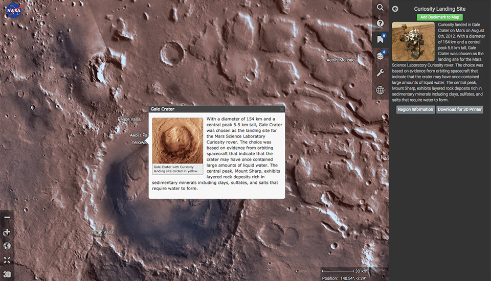
For example, Mars. The surface of the Red Planet is photographed very often, from the orbit, as well as directly from the surface. Naturally, scientists have a huge amount of information and photos of Mars available. Recently, NASA decided to make its data public, releasing a mapping service for Mars. This service is called - Mars Trek.
It represents an interactive map of Mars, composed of images obtained from multiple devices, both orbital and surface. Of course, this map is not as good as Google Earth, when zooming volcanoes and craters you won’t see details. But you can change viewing modes (south pole, north, community map), and zoom in or out the surface.
The map has several layers, each layer - a separate set of images of a particular device.
Interactive map would not be such if scientists do not allow users to edit it. In addition to the zoom and the angle, there is an opportunity to explore the most famous and important sight of Mars. In this case you should use the service «Bookmarks», which will show everything you need. Moreover, the user can load STL files if there is a need to print part of the surface of Mars in the form of a 3D model.
Digital cartography and GPS navigation 16-06-2015