


News about maps
Digital cartography and GPS navigation
Mapstor news
This Day in History
Travelling with mapstor.com
Digital cartography and GPS navigation
115 years of flight
Next-generation of GPS satellites are headed to space
DJI Phantom 4 RTK - cartography of a new generation
Earthquake prediction systems
OneSoil map
Millennial Features of Maps. Old Times
Maps - is a product on which worked countless people for more than six thousands of years. Cartography appeared earlier than writing and techniques of the earth and sea tracing have changed along with the whole human civilization: from the first cave paintings to digital online and offline maps that contain ethnographic, economic and social information about the inhabitants.
From the first day, when maps were used for navigation in the world, they had shortcomings: the river channel changed, fires destroyed forests, human settlements roamed from place to place, making it difficult to plot objects on the map. So the history of maps - it is also the ancient history of bug fixes in an attempt to create a perfect product.
Today, we are going to decide whether a century later, we got closer to the canonical scheme of reflection of the world.
Ancient map of the world
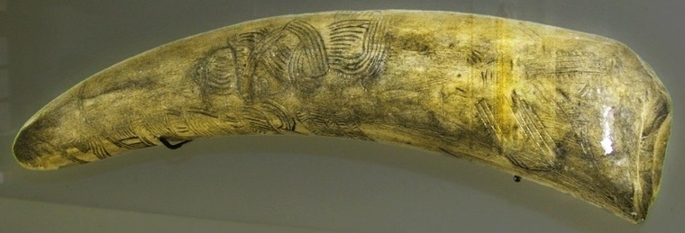
In the picture above you can see a replica of original piece of mammoth ivory, an found in the vicinity of the St. Paul city (Czech Republic). After years of research ornament on tusk was recognized to be the oldest known to date maps. Its age is estimated 25-27 thousand years. On tusk are depicted river bends, ridges, gullies of loose loess slopes, rocky peaks and hunters’ houses.
Even the creators of this map could not use it for long. It was necessary to change the picture every time, make a new map or find a fundamentally different way of navigation on the ground.
How to fix the image of the location, if the area changes so fast?
May be it’s better to orient by stars. Pole Star, part of the constellation of Ursa Minor, always points to the north, trending during the night just on a half a degree. Knowing where the Pole Star is, it’s easy to determine the points of the compass: when you look directly at the star on the right side is east, on the left - west, and behind - south.
The first constellations were allocated about 16 thousand years ago and were present in different drawings of Paleolithic art. Heavenly Nebra sky disk (≈ 3000 years BCE), which depicts the sun, the moon and 32 stars, was presumably used to measure the angle between the points of sunrise and sunset during the solstices.
View above
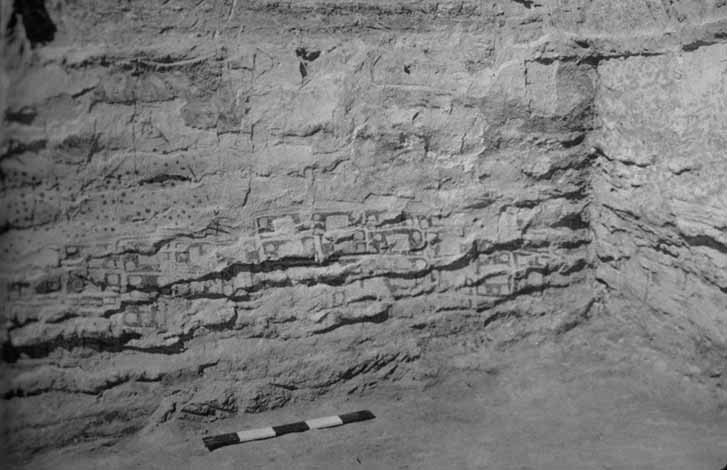
More than 6,000 years ago appeared first maps with view from above. Frescoes in the ancient settlement of Çatalhöyük are regarded as a detailed plan for the village. Streets in the village were not marked - probably the isolation of each house was showed by bright lines.
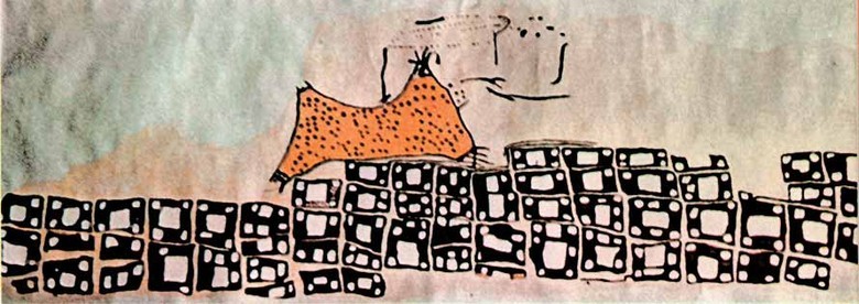
A modern reconstructed map of Çatalhöyük
Many authors later followed a similar pattern to display area. Almost all modern maps today are depicted from above.
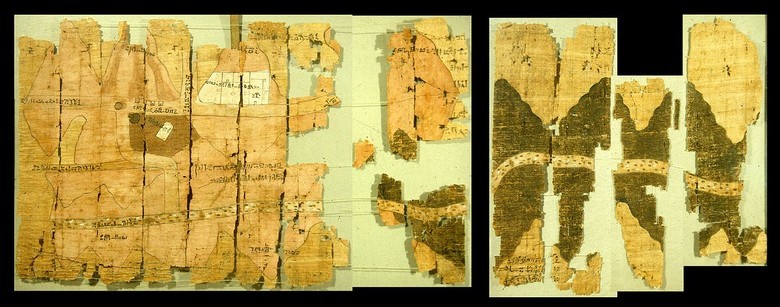
Detail of Turin Papyrus Map - the first known topographical map
The first map, which can now be called a truly great and extensive, appeared about 1160 BC. e. and depicts mountains to the east of the Nile. Reconstructed Turin Papyrus Map in a reconstructed form has dimensions of 280 by 41 cm.
Symbolism and Reality
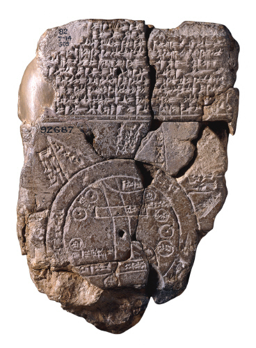
The first map of the entire known world (≈ 600 BCE)
Closer to our era cartographers are starting to mix the facts of politics/religion, distorting the real picture of the world. So, on the map of Babel there was no place for a well-known at that Persians and Egyptians, but a lot of attention was paid to the mythological elements and the edge of the world was displayed according to religious belief – the ring of the world's oceans.
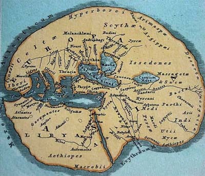
Land as thought Hecataeus, 5th century BCE
Similar "problems" arose hundreds of years to the Greeks. In ancient Greece, the world was depicted in the form of a flat disc, surrounded by constantly moving ocean currents. In the center of the disc were placed Greeks and on the edges were settled savages and monsters.
However, the mapping of the Greeks had projections, meridians, parallels.
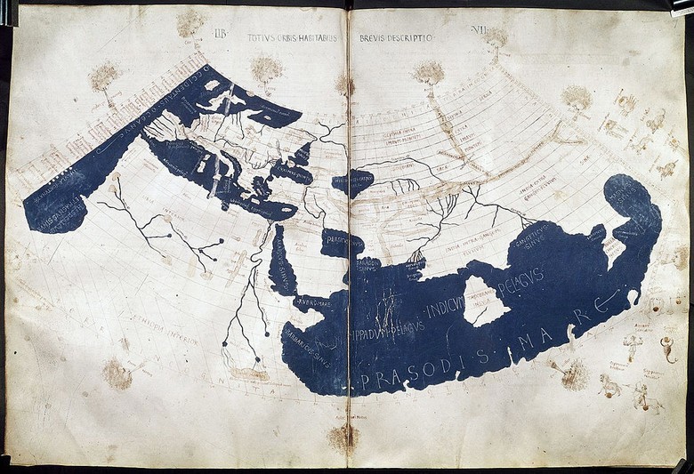
Reconstructed Ptolemy's map in the 15th century
With the advent of our time, and especially in the Dark Ages, the art of cartography in Europe was lost. When in China and in the Islamic world maps became more informative and more accurate, in Europe before the Age of Discovery the best map remained was of Ptolemy map, founded in the second century. Ptolemy developed a conical projection and stereographic map, pointed out the latitude and longitude of each place for easy retrieval, scale symbols with descriptions - the basic elements of the map that we use today. He also determined that the north on the map should be at the top, and east on the right.
Despite the large number of errors (for example, on a map were divided the Atlantic and Indian Oceans), this map remains popular for many centuries. For the territories of the interior of Africa, it was the only map till the beginning of the XIX century.