News about maps
Digital cartography and GPS navigation
Mapstor news
This Day in History
Travelling with mapstor.com
Digital cartography and GPS navigation
115 years of flight
Next-generation of GPS satellites are headed to space
DJI Phantom 4 RTK - cartography of a new generation
Earthquake prediction systems
OneSoil map
CityEngine: The City Builder
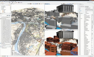
 Modeling a city poses a number of problems to computer graphics. Every urban area has a transportation network that follows population and environmental influences, and often a superimposed pattern plan. The buildings appearances follow historical, aesthetic and statutory rules. To create a virtual city, a roadmap has to be designed and a large number of buildings need to be generated.
The company Procedural Inc. proposes a system using a procedural approach based on L-systems to model cities. From various image maps given as input, such as land-water boundaries and population density, their system generates a system of highways and streets, divides the land into lots, and creates the appropriate geometry for the buildings on the respective allotments. For the creation of a city street map, L-systems have been extended with methods that allow the consideration of global goals and local constraints and reduce the complexity of the production rules. An L-system that generates geometry and a texturing system based on texture elements and procedural methods compose the buildings.
Digital cartography and GPS navigation 18-08-2008


