


News about maps
Digital cartography and GPS navigation
Mapstor news
This Day in History
Travelling with mapstor.com
Digital cartography and GPS navigation
115 years of flight
Next-generation of GPS satellites are headed to space
DJI Phantom 4 RTK - cartography of a new generation
Earthquake prediction systems
OneSoil map
Top of Cartography
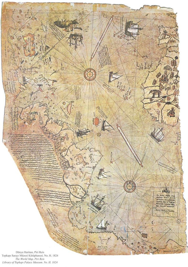
Restored fragment of Piri Reis map (1513) is considered to be the first true map of modern world. The map is a compilation of a variety of sources, contains a large number of puzzles, including the image area associated with Antarctica, discovered only in 1820. However, the hypothetical "southern land" was drawn on maps even before Piri Reis, based only on assumptions.
The invention of compass, telescope, sextant and other marine navigation devices, and subsequent period of great geographical discoveries led to a real boom in cartography. True masterpieces were created somewhere wrong in positioning of geography objects, but fine with details.
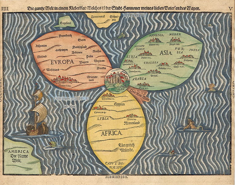
Map of Bünting Clover Leaf, 1581
In the 13th century the so-called "T and O" maps (Orbis Terrae, balloon of Earth), where "T" - is the Mediterranean Sea, the Nile river, and the river Don, separating three continents - Africa, Europe and Asia, and "O" - a circular ocean. The center of the maps is Jerusalem. Empty space on these maps is traditionally filled with images of mythical creatures.
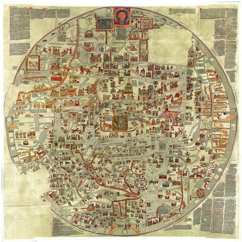
The biggest map, made in a T-O design is Ebstorf map created from the 30 skins of goats of a size 3,58 × 3,56 meters. It was not a travel maps, but was an illustration of the main objects of the universe.
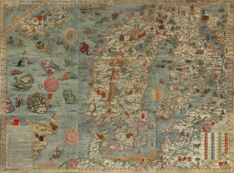
Copy of «Carta Marina» made in 1949
Map «Carta Marina» in 1539 is notable for the fact that for the first time images of creepy sea creatures began to bear practical use - they correspond currents, storm fronts, dangerous underwater rocks and shoals.
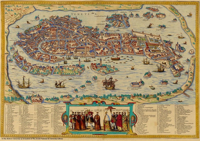
Map of Venice of 1565 is made in a style that is still used in tourist guides.
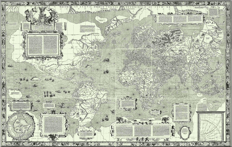
Conformal projection of Mercator, thanks to which it was possible to chart maps, in which the ship's course is represented by a straight line
In 1569, cartographer Gerardus Mercator, trying to make "look right" maps of the world developed a new projection using mathematical formulas. With the Mercator projection maps look familiar for us.
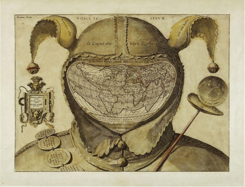
"Map of the World, placed at the head of the Fool", 1590
Map of Claes Janson Vishera «Leo Belgicus», 1611. Leo Belgicus - is the Latin name of the Dutch Lion. Since 1583 the Netherlands is often depicted as a lion. The map shows the period of truce between Spain and the Seven United Provinces of the Netherland.
In 1675 John Ogilbi painted the road on maps in the form of narrow strips, excluding all surrounding space, leaving only the objects necessary for orientation. This old map became the prototype in modern car navigation.
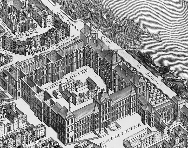
Fashion on the perspective view of maps was established by French in the detailed plan of Paris, composed in 1734-1736. In the above image is visible Louvre Palace. Almost three hundred years later, something similar was made for the Chinese search engine Baidu.
Have you heard about the "travel map"? On this map you can paint/erase a piece of territory where you have been, revealing the name and full geographical information. The first such map was created in 1761 by John Spilsbury/
By the 19th century map makers began to visually arrange economic, social and political information. However, until the mass adoption of digital maps in the 21st century, more information on maps quickly outdated.
Digital cartography and GPS navigation 21-02-2017