


News about maps
Digital cartography and GPS navigation
Mapstor news
This Day in History
Travelling with mapstor.com
Mapstor news
Track plotting and storage in SAS.Planet
Navigation software and offline maps to use with our maps
Transfer to HTTPS
Preview of maps in full size
Added 1443 large-scale topographic maps
Track plotting and storage in SAS.Planet
Having installed the program (http://sasgis.org/sasplaneta/) you should take time to configure maps that you'll actually use. The fact is that the program pre-installes dozens of different online maps, which don’t cover the region of interest. Unnecessary maps can be safely removed and, if necessary – unpacked from the program's archive. All these operations are performed in the folder\Maps\sas.maps, where we placed our offline maps here. Just go to any directory with a group of maps and remove all unnecessary ones. You can also change the position of any map in the menu by editing option ParentSubMenu in params.txt file for each map.
In the program you can combine data from different maps on a single screen. For example, use as a base map satellite image, and as additional layers include OSM hybrid layer, Wikimapia data layer and pictorial layer of Panoramio.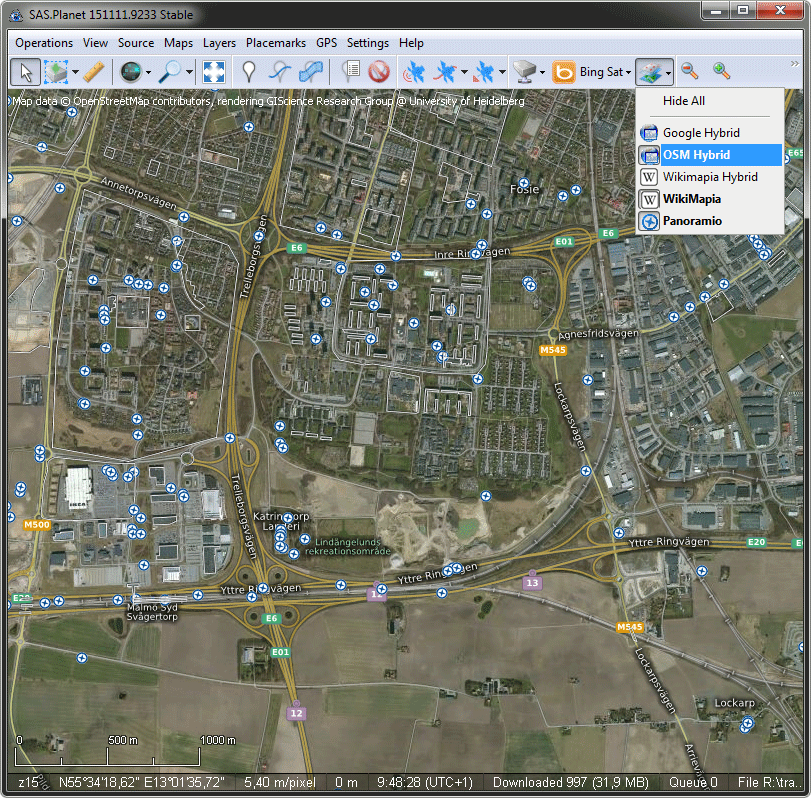
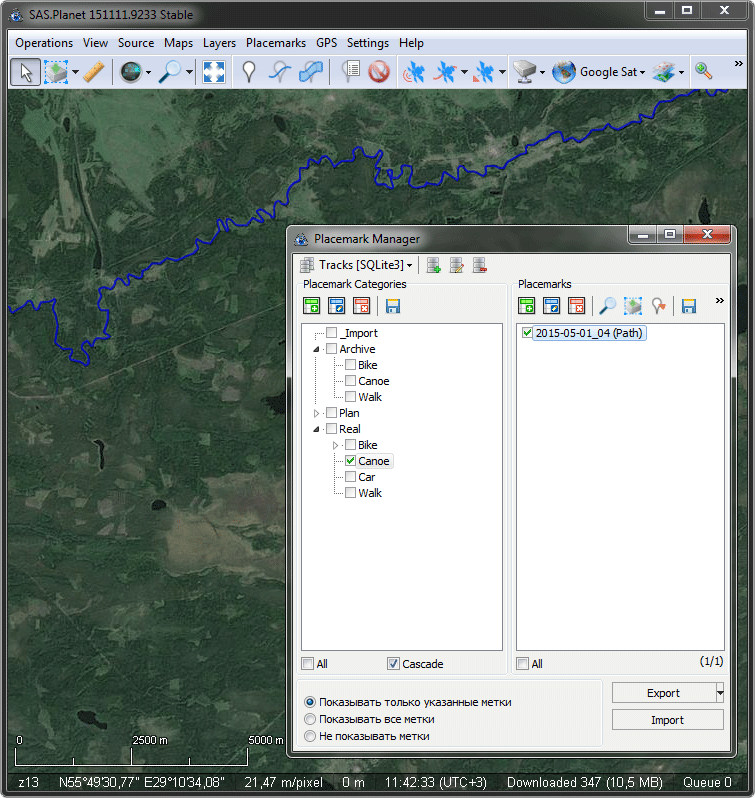
Next you need to set up a storage for tracks and locations. To do this, go from the main menu to the Placemarks>Placemark Manager. The top line of the window contains database management button. Please remember where you save database files, so that later not to lose your entire archive of data!
Each database is represented in the window Placemark Manager as a tree of folders (on the left) and the actual tracks or placemarks (on the right). It is convenient to create a root folder for the planned track, archived and imported tracks, etc. For specific tracks, you can add text descriptions of any size.
Track plotting
- Start drawing or open existing track for editing
- Switch between maps and satellite images to get an idea of the terrain (at the satellite image old roads may not be indicated as well on old maps non-existent roads can be indicated)
- If necessary you can move to any segment of the route and makes adjustments
- Save track by defining category in the database and the name