


News about maps
Digital cartography and GPS navigation
Mapstor news
This Day in History
Travelling with mapstor.com
This Day in History
4th December, 1674 Marquette founded the first European settlement
19th November, 1875 was born Hiram Bingham
18th November, 1832 was born Nils Adolf Erik Nordenskiöld
14th November, 1963 the island Surtsey was founded
11th November, 1729 was born Louis Antoine comte de Bougainville
6th December, 1492 the island of Haiti was discovered
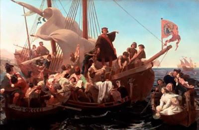 On the 6th of December, 1492 Christopher Columbus discovered and mapped the island of Haiti, located between Puerto Rico to the east (separated by the Straits of Mona) and Cuba in the west. You can see on that the width of the Windward Passage, which separates Cuba and Haiti, is 77 km.
Discoverer told the world about the existence of Cuba, and after 40 days in the 100km to the south-east of it found a large island called "La Isla Espanola," which means "the Spanish Island." Subsequently Dominican priest Bartolome de las Casas cut it down to one word - Hispaniola. In 1530PietroMartired'Angierapublished an essay "Decade of the New World", which contained a detailed description of the island in Latin, and the name the author translated as "Hispaniola". Later the work was translated into English, German and French, and the name stuck cartographers. The modern name of the island is derived from the Arawak Indian language, and is translated as "land of high mountains."
The island was discovered on the day of St. Nicholas, so a bay on the north-western tip of Haiti was named Puerto de San Nicolas. In his diaries, Columbus described Haiti as "magnificent valleys, which stretch along the coast and resemble land of Castile, but in many ways superior to its past beauty." Here Columbus founded the settlement Villa de la Nividad and left 39 settlers. When the explorer returned to Haiti in 1493 he found that the Indians massacred the entire garrison. At 32 miles east of the land where he fort was destroyed Columbus founded a new settlement - Isabella (on modern maps can be found as the city of Santo Domingo). Reclaimimg of the island was continued by his brother Admiral - Bartolome. Haiti was declared a possession of Spain, but colonization has affected mainly the eastern parts of the island. Local communities have been destroyed, and black slaves were imported here to work on plantations and mines.
In 1625 near Tortuga off the northwestern coast of Hispaniola settled French and English pirates, that raided against the Spanish colonizers. Gradually French began to supplant the British and began to actively explore the northern coast of Haiti.
In 1697 poor in gold western third of the island became under the control of France and was known as San Domingo. On maps of that time the Spanish part of the island was marked as Santo Domingo. The border 375 km long separated two colonies, which in future turned into the Republic of Haiti and the Dominican Republic.
In the XVIII century San Domingo was the richest French colony with plantations of coffee, cocoa, sugar cane and cotton. By the end of XVIII population of the colony numbered 42,000 whites, 50,000 blacks and mulattos, who though they were limited in their rights. But most of the population were slaves negros. There were more than 450,000 people.
Topographic map shows the location of the island of Haiti, which is the second largest after the Cuba Island in the group of the Greater Antilles in the Caribbean Sea. Its area is 75 300 sq.km with population of over 200 million people.
This Day in History 06-12-2013