


Articles about maps
History of cartography
All about topographic maps
Topographic maps and traveling
Two centuries of Russian Cartography
Navigation software and offline maps
History of cartography
Cartographic maps of ancient East
Cartographic maps of ancient Rome
Cartographic pictures of primitive people
Cartography and geography in ancient Greece and Hellenistic countries
Cartography and geography in Armenia and in countries of Arab Caliphate
Cartography in slave-holding China
First Maps
Literature and Astronomy
Pythagoras and first hypothesis about Earth’s size
Strabo and cartography
The development of Russian Topography
The origins of astronomy
The origins of cartography
Why we so many ancient maps diasappear?
Pythagoras and first hypothesis about Earth’s size
The name of Pythagoras takes pride place in the history of science; he is credited with several important scientific hypotheses, which later proved to be true. 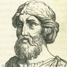
Perhaps the most important of his theories is the assertion that the earth is not flat, but round. How Pythagoras was able to come to such a conclusion - a cornerstone of cartography – is a mystery. The Pythagoreans, developing ideas suggested by the wizard, built around his spherical earth a new space system; while they rejected in many respects all previous concepts, including concepts of Pythagoras. They left the earth spherical, but abandoned the geocentric hypothesis, relegating the Earth from the center position of the Universe to the status of one of the planets - the same as Jupiter and the sun. Then they designed a system in which celestial bodies, including the sun, revolved around certain "central fire" of a mysterious origin.
Aristotle thought that the universe is finite and has a spherical shape. He said that the Earth is round, because the horizon line that intersects the rising and setting sun, was straight, not curved. This straight line at a glance, Aristotle reasoned, - an optical illusion caused by the huge extent of the horizon and relatively small size of the scope of the rising or setting sun.
The finishing touch of early philosophical astronomic system, related to cartography, was a radical hypothesis of the "mathematician" Aristarchus of Samos (310-230 BCE). He created a sophisticated sundial, the base of which was a not a plane, but had a concave hemisphere, in the center of which was fixed vertical pointer; direction and the height of the sun thus can be determined at a glance. He wrote about optics, light and color.
Once the hypothesis of Pythagoras gained general acceptance and the Earth took shape of a ball, immediately followed attempts to determine its size. From early estimates the largest size of the Earth was determined by Plato in its "Phaedo" and equaled to 400, 000 miles.
Archimedes, in his book "Calculation of grains of sand" says that since then this figure by common consent has been reduced to 30 000 miles. By that time the Earth's measurement among scientists was very popular pastime, but for many years nothing was said about the methods of such measurements.
The earliest authentic description of the method by which the Earth was measured for the first time belongs to Eratosthenes Kirensky (276 BCE). He was a man of versatile knowledge, received a great scientific and philosophical education.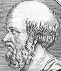
Eratosthenes method was based on several known or assumed facts:
- the distance in a straight line between Alexandria and Siena (now Aswan) is 500 miles;
- Alexandria and Siena are located on the north-south line, or as it formulates Cleomedes, "on the same meridian circle"
- Sienna is located on the edge of the tropical year (that is, on the Tropic of Cancer) - a fact confirmed like Pliny, Arrian and others, as the summer solstice in Siena in the midday sun is directly overhead; at this point the gnomon casts no shadow, as the sun rays are reflected in the water at the bottom of the deepest wells.
Further observations showed that the summer solstice at Alexandria midday sun is not directly overhead and casts a shadow at an angle equal to one fiftieth of the circle. If so, then the angular distance between Alexandria and Siena is equivalent to one fiftieth of the length of the Earth's circumference. So, if the distance in a straight line between the two cities is 500 miles, the earth's circumference would be fifty times, or 25 000 miles.
This universal and natural idea prevailed till 1671.